Success is getting what you want; happiness is liking what you get
Showing posts with label Lighthouse. Show all posts

Thursday, 21 April 2022

Solway Park and a Trip to the Coast

It was time to pack up and leave Timona Park, and move on to our next stop, Solway Park Showgrounds in Masterton, a distance of 121km.  We were a little late leaving as we had a family breakfast to attend at one of the local cafes.  Once back in camp, we hooked up, and made the obligatory visit to the dump station.  Then off we went, driving over the Saddle Road.  And there they were, those wind turbines up on the hill, working away to turn the power of the wind into electricity.

P1040102

We hadn't travelled too far when we came to a grinding halt, stopped by a young women in high viz holding a stop/go pole, which we noticed was taller than she was!  After waiting in line for ages, a slow stream of cars and trucks trundled towards us.  Finally we got the go signal and off we went, driving past the problem on the road, a tree had come down in a land slip and was covering one of the lanes.  A team was working hard to clear the road and get traffic moving properly again.  

P1040103

Hold up on the road

Once over the Saddle Road, it was easy driving from there on.  Oh look, there’s the “world famous in  Mangatainoka” Tui Brewery tower.  There is a freedom camping area across the road from the brewery down by the river, but we weren't stopping here, and continued on our way.

P1040105

Tui Brewery at Mangatainoka

We soon arrived at our destination, found a site and Robin went to pay for our three night stay here.  This is a lovely place to stay, beautiful grounds surrounded by magnificent mature trees.

P1040117P1040110

Solway Park

P1040109

The historic grandstand peeking through the trees

With a brand new NZMCA park at Riversdale we packed a picnic lunch on Thursday and set off to check it out.  We drove through pine forests, meeting up with heavily loaded logging trucks on the road, finally arriving at Riversdale.  The newly opened  park is quite small and can accommodate 28 vans.  At this stage there is no water or rubbish facilities available, and we were surprised to see about a dozen vans on site.

P1040120

P1040121

Riversdale Beach NZMCA

P1040123

The pretty little St Joseph’s Catholic Church is close to the camp

P1040125

Riversdale Beach was a bit wild

Next stop was  at the tiny hamlet of Tinui at the cemetery and the start of the Tinui Walkway.  Tinui was the first place in the world to have a formal celebration of Anzac Day. Back in 1914 there were well over 1000 single men in the area, many volunteered to the services and some lost their lives.   In 1916 Rev Basil held an Anzac ceremony at Tinui on the hill top and erected a cross.  This cross was later replaced and is in the original position on top of the hill overlooking the village.  The popularity of this Anzac Day Service has grown enormously over the years, with visitors and locals alike making the early morning trek up the hill.  In the car park we saw the Memorial to Peace boulder, donated by a local family.  This huge rock is local sandstone/shale concretion and dates from 70-80 million years ago.

P1040131

Memorial to Peace Boulder at Tinui Walkway

Back in the car again and we drove to Castle Point Beach to see the lighthouse.  Castle Point Lighthouse is the North Island's tallest lighthouse standing 52m above sea level and is one of only two left in New Zealand with a rotating beam. It is owned and operated by Maritime New Zealand.  There is a walkway up to the lighthouse which we had walked up previously.  Not this time though, not with my sore back and Robin’s sore knees, we decided to admire it from the car.

P1040132

Castle Point Lighthouse

P1040133

Some heavy duty boats parked up on their trailers

We had taken a picnic lunch with us, so sat in the car looking out over the beach while we enjoyed our sandwiches and coffee.  This beautiful sandy beach seems much more suitable for paddling and swimming than Riversdale Beach, and we noticed several family groups enjoying the water.  Not too bad for April, we thought.

P1040134

Castle Point Beach

That was the end of our coastal adventures so we made our way back to Masterton, stopping off to buy some fresh strawberries from the Wee Red Barn cart.  They will be nice for dessert, and maybe some for breakfast as well.  Back at Solway Park we noticed that horse jumps had been erected in the show grounds.  There is going to be a 3 day horse jumping event taking place, so things will be very busy, and noisy too, we were told.  Just as well we are moving on tomorrow.

P1040135

Ready for the horse crowd

Tuesday, 1 February 2022

Moving on to Opunaki

There was a bit of a treat on our final morning at New Plymouth.  There seemed to be a bit of police dog and handler training going on – that was worth checking out, I decided.    So I walked up and asked if I could take a photo of the dog.  Guess an old lady on a walking stick didn’t look too threatening to those big strong policemen and the dog.  No problem at all, the handler walked his dog over closer to the fence and instructed him to get down, so I could take a quick photo.  He certainly was a fine looking animal.  We had noticed aa sign on the enclosure next to where we were parked up saying “Police Dogs only”, and were told that they come here to train as it was neutral territory.

IMG20220131102511

IMG20220131102614

Police dog training going on

Then we were on our way – first stop to refill our gas bottle, go to the dump station, and then we followed Surf Highway 45.  This is quite an interesting road, passing several small beach towns on the way.  Oakura Beach holds special memories for Robin, as he spent quite some time at this surf beach in his younger years doing Surf Life Saving training.  We stopped for lunch at Cape Egmont Boating Club, pulling into a large grassy area with two others in our party.  There were plenty of cars and boat trailers dotted around.

P1030495

Lunch time

The boat club has a replica lighthouse attached, which also serves as a museum, not open when we were there as it it run by volunteers on an occasional basis.  I climbed up the ramp and got a good view out over the beach and boat ramp.  That’s where the fisher-folk go to launch their boats and try their hand catching those elusive fish.

IMG20220131133434

Replica lighthouse and museum

P1030496

Looking down over the boat ramp

After a relaxing lunch we continued on our way around the coast to Opunaki, passing hundreds of small rounded hills in the paddocks, as far as the eye could see..  These were created by ancient lahars flowing from Mount Taranaki.  A lahar is a rapidly flowing mixture of rock debris and water (other than normal streamflow) originating from a volcano

P1030492

Small lahar mounds

Our ICA group all trickled in to Opunaki Beach Holiday Park during the afterrnoon, found our allocated sites, and settled down for our first afternoon here.  The peace was shattered when a Life Flight Rescue helicopter landed in the motor camp car park.  Seems an ambulance was called in first, and then needed back-up from the helicopter.  Sadly, one family's holiday is now in tatters.


Saturday, 7 March 2020

Ngawi and beyond

The weather was wet, rough and blowing a gale during our second day at Cape Palliser, no gathering outside for us.  After lunch things started to improve so we headed off to Ngawi, a small fishing village  just a short way up the road.  Ngawi has more bulldozers per capita than anywhere else, we read.  The bulldozers are used to haul fishing boats into and out of the water as there is no wharf or other access to the ocean other than the beach, which can be notoriously rough.  Ngawi is known for its exposed climate, its intense and prolonged wind and the fact that there are almost no trees nearby. The weather can be extremely hot in summer.  We parked on the shingle and went to check them out, beside the shiny red bulldozer dwarfing our car.
P1340228

P1340253P1340251
Bulldozers and fishing boats on Ngawi Beach

It was a few kms up the road to  see Cape Palliser Lighthouse,  perched high on a cliff, and owned and operated by Maritime New Zealand.  The lighthouse  was built in 1897 and was originally fueled by oil.  Several changes were made over the years, the oil lamp was replaced with an electric one powered by a local diesel generator,  later replaced by a connection to the mains grid in 1967, and the light was fully automated in 1986 and is now managed from a control room in Wellington.

P1340232
Cape Palliser Lighthouse

The base of the lighthouse is reached by climbing a staircase with 258 steps, up a 58 metre cliff. The staircase was built in 1912, and replaced a dangerous dirt track.  We decided not to climb the stairs this time, although we certainly did on our last visit here.  There were a couple of brave souls climbing very slowly down the steps, we noticed, perhaps they were having knee problems too?

P1340229
The steps up to the lighthouse

There is a large fur seal colony in residence at the cape with the breeding season from mid-November to mid-January.   We saw seals on the rocks, and laying about, looking  fat and contented,  on the grassy shore.

P1340246

P1340249P1340241
New Zealand Fur Seals

This sign certainly piqued our interest- wonder where the house owner got it from?  We are sure there is no ice on this shore, falling or otherwise!

P1340234
Sign at the beach

Our trip to the end of the road to see the sights  certainly blew the cobwebs away.  Then it was time to head back to camp and put the kettle on and warm up with a hot drink – this area has rather bracing conditions! 


Saturday, 18 August 2018

Rottnest Island

Overnighting on Rottnest Island gave us two days to have a good look around, and we wondered if we would  get to see those little animals we had read about, the quokka.  We were picked up bright and early from the hotel by the courtesy coach and taken down to the ferry terminal to board the Rottnest Express.

    P1210550

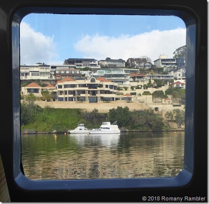
The first part of the journey took us for a scenic cruise along the Swan River and past where all the rich people live.  This area is called Millionaires Row.  Several dolphins were following the boat, swimming in the wake, and treating us to energetic leaps out of the water.

P1210516
Where the wealthy people live

P8161052
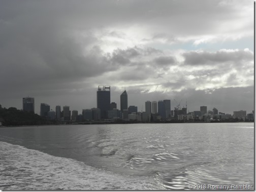
Leaving the Perth skyline behind us

We arrived at Fremantle to see huge container ships in port, most of them seem to be car transporter ships or container ships.  And by contrast the “Fremantle Rainbow” is a piece of modern sculpture made from shipping containers.

P1210531P1210526
Fremantle Port

Then it was across the open sea to arrive at Rottnest Island.  The island is 11km in length and 4.5km at the widest point.  No domestic cars are allowed, only service vehicles and a few tour buses.  It is a bikers paradise.

P1210571

Rottnest Island was named by Dutch explorer William de Vlamingh in 1696, meaning rats nest, mistaking the quokkas for huge rats. A quokka is a marsupial the size of a hare or domestic cat, and as with other marsupials, such as the kangaroo and wallaby, the females suckle their young in a pouch. Quokkas are generally nocturnal and spend most of the day sleeping and resting under shady bushes and dense vegetation. But on the island they can be seen opportunistically feeding during the day, and are not the least bit shy of people.  It wasn’t long before we saw our first quokka, there were plenty around the small shopping area close by the wharf.  With their dark brown fur and long hairless tail, it was no wonder that they were confused for a large rat at first sight.

P8161066
Our first quokka

After booking into our accommodation for the night, it was time to board the bus for our “Discover Rottnest” tour.  The bus had to carefully drive past crowds of cyclists who were exploring the island by pedal power.

P1210573P1210578

The island is rugged and windswept, with great fishing, we were told, and lovely clear water.  Dolphins live in the waters, and whales come by on their annual migration.

P8161056

Our guide stopped the bus so we could see a huge osprey nest built on a rock a little way out in the sea.  We could just make out a little head sticking up, it is Mum sitting on eggs perhaps?

P8161057
Osprey nest

This imposing Wadgemup Lighthouse was built in 1896, with a 45,000 candle power revolving first order dioptric light.  This was the last lighthouse in Australia to become fully automatic, in 1986.  Wadgemup is the old aboriginal name for the island and means “place across the water where the spirits dwell”

P1210623
Wadgemup Lighthouse

Another quick stop a little further along to show us a sleeping quokka.  They sleep all curled over.

P1210629
Sleeping quokka

The next stop was at the West End Boardwalk, nice easy walking over recycled plastic, which needs very little maintenance, we were told.  The wind was ferocious, and the coastal views spectacular.  With the crumbling rocks and pounding waves we were warned not to veer off the pathways.

P1210635

P8161063
At West End Boardwalk

Damian, our tour guide, who also worked on the ferry, was very informative and kept us entertained the whole trip. A great way to see the island and find out some of the history.

Friday, 29 December 2017

Catlins Heritage Trail

The little rental campers and cars kept coming in during the early evening, with about 8 joining us overnight.  A few pitched tents, and one had the tent on top of the car.  No way would I go camping in that, I told Robin!

P1110471
This is not my idea of a camping holiday

We left the camp bright and early, driving out under the intriguing entrance to the camp/café.  That’s a little rail cart used to haul lignite up on top of rail lines, a very clever idea indeed to use it to make such a stunning entrance.

P1110482
Entrance to the property

The plan today was to follow the Catlins Heritage Trail, then return back along the Southern Scenic Route.  Although we had seen most of the attractions when we were down this way six years earlier, we decided to have another look at what the area has to offer.  The Catlins region owes its name to Captain Cattlin, (1792 – 1856),  with a slight difference in spelling, a Sydney-based whaling captain who traded along the South Otago coast. In 1840 Captain Cattlin bought a vast tract of land from local Maori in order to stake his claim on the area, however, after years of negotiation, most of the purchase was disallowed.

We started our trip visiting Fortrose, situated at the mouth of The Mataura River.  A whaling station was started in 1834, but was soon abandoned, but this whale pot survived, which was used for rendering down blubber.
 
P1110501P1110485
Fortrose Beach whale pot and freedom campers parked up looking over the beach

A good part of the road was dusty and unsealed with the 4WD bumping along with the windows wound up tight to keep all the dust out.  But we were pleasantly surprised to find nice new seal on the road to Slope Point.  The car park was a new addition since our previous visit, we just parked along the road side before.  And we made sure that we were well rugged up for our walk over farmland to Slope Point, remembering the viciously cold winds that buffeted us around last time.  The ugly little squat lighthouse on the point was not at all romantic and attractive, as lighthouses often are.  But it does the job, so that’s the main thing.

P1110512P1110519
Slope Point Lighthouse

Slope Point is the most southerly point on the South Island, and is 7kms further south than Bluff.  Those nasty cold winds were not in evidence today, and scores of young tourists arrived being less warmly clad than us.  We asked a tourist to kindly take our photo, then returned the favour to several other couples and family groups.

P1110522
No nasty cold winds at Slope Point today

slope point all
It was so much colder 6 years ago – Geoff, Dot, Pauline, Robin, Jenny and Derek

PC290542
View from Slope Point with Waipapa Lighthouse in the distance

And to prove how the winds howl through this area, check out these trees with all the foliage blown off the windward side.

P1110534
Trees at Slope Point

We traveled on to Curio Bay, the home of a petrified forest.  At low tide petrified stumps and fallen trees can be viewed, due to a disaster which happened a mind boggling 180 million years old during the Jurassic period.   The forest was killed suddenly by an eruption of volcanic ash, with the ash  forming the hard sandstone beds in the cliff edges.  Eventually the sandstone strata were cut back by sea action, to reveal the broken logs and stumps still in their original positions.  Luckily our visit coincided with low tide.

P1110549

PC290545PC290546
Curio Bay and the Petrified Forest

A brand new Information Centre and Café has been built here since our last visit, and has only been open for two weeks we were told.  The project was built by the South Catlins Community Trust as the local community was concerned that increasing numbers of visitors were impacting negatively on Curio Bay and its wildlife due to lack of suitable infrastructure.  The Curio Bay Tumu Toka Natural Heritage Centre will now  provide employment and protect this precious area for the enjoyment of current and future generations.

P1110557PC290547
Natural Heritage Centre at Curio Bay

The next bay along the coast was the very pretty Porpoise Bay,  and we were lucky to see some Hector’s Dolphins playing in the water.  They were a little hard to see, with their fins breaking the surface as they frolicked around a group of surf boarders.

PC290551P1110569

P1110560
Porpoise Bay and sighting of a dolphin

Another place we hadn’t stopped at previously was the old concrete horse trough, built in 1890, a stop to water the horse teams after they had climbed Cemetery Hill.  The trip down the hill was often perilous, with the brakes sometimes failing on the Waikawa-Fortrose coach on the downhill journey.  The concrete trough is now unused and overgrown, but is still an interesting piece of colonial history.

P1110577
Old concrete horse trough

Don’t laugh – but New Zealand has it’s own tiny version of Niagara Falls.  They were so named by a surveyor who had seen the mighty Niagara Falls and named these small falls after them as a joke.  They are really just a trickle, and people come from far and wide to look and wonder!  The NZMCA Niagara site is close by and was had quite a number of vans staying there.

P1110587
Niagara Falls – Kiwi version
We drove back to Fortrose along the Southern Scenic Route and enjoyed an ice-cream before continuing back to camp.  What a great day exploring, and seeing again some of the attractions of this area.