Success is getting what you want; happiness is liking what you get
Showing posts with label River. Show all posts

Tuesday, 23 January 2024

Whanganui - Unesco City of Design, and Pipiriki

Whanganui is an unique blend of heritage architecture and cutting edge creativity.  Unesco has welcomed Whanganui to its Creative Cities Network, a first for New Zealand.  Congratulations, Whanganui, what a wonderful honour!

On our last full day in Whanganui, we invited Maureen and Russell to join us for a drive to Pipiriki and a picnic lunch.  It was many years since we had driven this road, so long ago that in those days it was a gravel road, although it is now sealed.  Narrow and windy, it took us through tiny settlements with interesting names, rather like those associated with the Grand Overseas Tours taken by young men of the aristoctracy in earlier years.  These interesting little places have now reverted to their Maori names.  Athens, now known as Atane, Corinth, now Koriniti, London, now Ranana, and Jerusalem, now Hiruharama.  We stopped at a lookout point along the way for a lovely view down the river.


The Whanganui River

One of the places we were keen to revisit was the Kawana Mill, in fact, we wondered if in fact it was still there, after all these years.  Luckily it has been well cared for by the NZ Historic Places Trust.  This is the only remaining one of six mills  dotted along the river to mill corn and wheat grown by the Maori people back in the day.


Kawana Mill and Waterwheel

The Miller's Cottage was close by but locked up tight, so we could only peer through the windows.


Miller's Cottage

From here we continued on to Pipiriki and found a nice shady spot in the picnic area to eat our lunch.  This little settlement is the hub for jet boat rides up the river.  We met up with friendly young German tourist who had arrived with her bike off the boat and was planning to cycle to Whanganui - wonder if she realised just how hilly the road was?  She kindly agreed to take our photo for us.  


 Robin, Jenny, Russell and Maureen at Pipiriki

In the grounds was the remains of a totara canoe which used to ply the river, this is just half the remaining length.  And could carry 100 Maori warriors, the sign told us.


Remains of a Maori canoe

Across the road from this rest area was a hotel building which we remembered from our earlier trip all those years ago.  It was never completed, and the story goes that the locals warned that if the building project went ahead it would be razed to the ground.  Why, we are not sure, but there was obviously conflict between the owner/developer and the local population.   So here it sits, still in this condition.


The abandoned hotel project

WE decided that instead of returning the way we came, along the very narrow and windy road, we would take the longer way back through Raetihi and the Paraparas.  There was certainly evidence of the big slips which had come down on the Paraparas a year or so ago, but the damage all seemed to be resolved.  There was another stop along the way, to stop and admire the Raukawa Falls at the lookout.


Raukawa Falls

It was a long day but we eventually arrived back in camp just in time for 4zees.  In fact, Geoff was sitting outside under his awning and had started before us.  We fired up the BBQ to cook our steak, and after dinner gathered outside again in the cool of the evening to enjoy each other's company.  It had been a great day.

Whanganui is an area with a very strong connection to the river.  There is a saying here which sums it up.  "The great River flows from the mountains to the sea.  I am the River, the River is me,"


Monday, 22 May 2023

Very Wet at Whanganui

The weekend rally with the caravan club was held at Whanganui River Top 10 Motor Camp.  With instructions not to arrive prior to 2.00pm, we met up with Owen and Helen on a lay by and spent some time enjoying our respective lunches  with them.    Then it was time to move on, arriving at the camp just after 2.00pm – surprise, surprise, there were plenty of early bird club members already there.  The instructions were to keep off the grass, which was sodden, and we maneuvered the vans onto concrete pads.  These are obviously made with camper vans in mind, as they were not very big at all.  There was a great turnout for the weekend, with 11 vans in total.

P1020649

Whanganui Top 10

The facilities at this camp are excellent, and the following morning I took a little walk around to the wet grounds to see what I could see.  The Whanganui River is right on the edge of the camp, and the locals have a saying about it.  “I am the river, and the river is me”. 

P1020648

Whanganui River

There was a playground for kids, and a bird aviary.  Those birds didn't want their photos taken, when I approached the netting, they quickly flew right over to the other side.  There was a well stocked herb garden and a multi armed sign post showing you where to go, or maybe, where you have come from.

P1020647P1020650

Around the camp

On Saturday afternoon the rally families had us driving around and jumping in and out of cars.  Each car had a team of four, and we were sent on our way with a list of instructions to find various things around the town.  Plus we had to take a cell phone photo to prove we had been there.  Our instructions took us to the Drurie Hill elevator to confirm what year it had opened – way back in 1919 as it was a way of getting home owners from the new Drurie Hill subdivision down the hill to work and school.  Previously, they made their way up and down a very steep line of steps – imagine doing that with a pram and a couple of toddlers!

P1020652

This way to the elevator

Then it was in the car and back up the hill to check out the Memorial Tower. Questions to be answered were – how many steps to the top of the tower, 176 it stated on the plaque so we didn't have to clamber up the top, counting as we went.  And 513 people from the Whanganui district died in WW1.

P1020653

Memorial Tower

One attraction we had to find, which none of us knew about, was the Queen’s Park Carillion.  We were expecting to see a concrete tower, but it was not constructed like that at all.  The Carillion in Queen's Park was installed in 1981 to mark the opening of the Farm Equipment Company's new factory in Wanganui. The company was owned by Dutch firm P J Zweggers en Zonen, and as this was their first factory to be built outside Europe, they wished to provide a traditionally Dutch gift to the town.  The bells were constructed in the Netherlands by prestigious bell foundry Petit & Fritsen and installed in Queen's Park by Emmett Brothers. The Carillion is equipped with eighteen bells and can be controlled manually by a keyboard housed inside the plinth, while it uses a hole punched plastic tape to play programmed melodies. 

Very attractive Carillion with 18 bells

Our car trip ended with us all finding our way up past Virginia Lake to the Pukeko’s Nest CafĂ© for an ice-cream, or coffee.  It certainly was an afternoon with a difference, taking us out and about around Whanganui.

P1020657

Time for refreshments

In the evening we all pooled cars again and drove to the Whanganui East Club for a meal.  Lots of nice choices, but sadly to Robin’s regret, the lamb shanks were no longer available.  We had roast pork instead, and very nice it was too.

P1020661P1020660

Dinner time

It rained incessantly on Saturday night and we awoke to news of flooding, trees down, and road closures.  This certainly made getting home a bit of a trial.  Robin was taking the caravan up to Ohaupo for a service and I was taking Gemma home in my little car.  Getting out of the city was a challenge in itself as I came across a road closed sign, was sent up the hill to the water tower and back down again hoping to get on my way, but no, this part of the road was closed too.  So I decided to back track and take the country road to Fordell, getting lost a couple of times along the way.  More detours, another road closed, driving through water flowing over the road, help, get me out of here.  I found out later that flooding and slips forced the closure of parts of State Highway 1 and State Highway 3 after torrential overnight rain, no wonder I had to travel so far along narrow roads to get back to the main road.  I was so thankful to get back home safely.  Robin just took things quietly on his trip north and arrived at his overnight stop safe and sound too. 

Anzac Parade State Highway 4 in Whanganui was closed between Georgetti Rd and Mt View Rd due to a slip. Photo / Finn Williams

Anzac Parade State Highway 4 in Whanganui was closed due to a slip. Photo / Finn Williams

No wonder I had so much trouble getting out of town on Sunday.  I was concerned about Gemma being in her carry cage for much longer than anticipated, and must admit driving in those conditions was a worry for me.  But it all ended well, thank goodness.


Monday, 1 May 2023

Weekend at Shannon

We spent the weekend with the caravan club at Shannon School.  Being a school day, there was supposeably no entry to the grounds till 4.00pm, but I suspect most were on site earlier than that.

P1020580

Shannon School

It was a bit of a tight squeeze through the gates, and we were parked up on two adjacent areas.  For those, like us, with longer vans, it took quite a bit of maneuvering to slot into place.

P1020581P1020582

We all managed to squeeze in

Once we got organised, and the legs wound down, Gemma found the caravan wardrobe door open and squeezed inside for a while, she loves these kinds of hidey holes. Just look at that cheeky face peeking out.

P1020579

Here’s looking at you, Mum

The use of the hall was included in our fees for the weekend, and we gathered there on Friday evening.  Some of the longer term members were encouraged to reminisce about the early years of the club, places we had visited, things we had got up to in our younger years.  And how the clubs had changed over time, with several of the local clubs no longer in existence.

On Saturday afternoon Robin and I had planned a mystery tiki tour of the local area, to conclude with a BYO afternoon tea.  Cars were shared and off we went.  First stop was quite a marvel of engineering, the Moutoa Sluice Gates.  These were built in 1962 as a flood protection measure.  The Manawautu River here runs very sluggishly, and when in flood the river would overwhelm the stop banks and flood farmland.  The sluice gates cause much of the river flow to take a short cut, bypassing 30km of low capacity river channel, directing the flow down the 10km Moutoa Floodway.  This happens about every fifteen months or so.

P1020585

Moutoa Sluice gates

Back down the road a short way we stopped again, at the site of the WW11 Whitaunui Military Defaulters Camp, one of two in the area.  Sadly, nothing to see now, but in it’s time the two camps housed 250 conscientious objectors. The huts used to house the men were built by the Public Works Dept., mostly two men huts measuring 8ft by 10ft together with some single men huts.  The unheated huts were furnished with beds and straw mattresses, a pillow, and old army blankets.  The men were also provided with a small table and stool.  You could imaging how cold the winter conditions would be.  The men were required to work in wet conditions, cutting flax.  One of the more famous detainees was Rex Hilary, brother of Sir Edmund Hilary.

P1020604

Photo of the huts at the Detention Centre

Back in the cars again we headed up to the hills for our final stop, the Mangahao National White Water Centre.  No races down the river this day, of course, but we could see the overhead rails all in place.  Thousands of man hours were poured into making rock groynes, clearing out the river and establishing the site.  Throughout the 70s and 80s the Mangahao White Water Park hosted dozens of successful events.  Over the years the park has been upgraded to international standards, and training takes place here by locals and international teams.

P1020596

Part of the course

There were handy picnic tables on the river bank so we settled down to enjoy our afternoon tea.  Out came the thermoses, the coffee and biscuits, and we all soaked up the peaceful atmosphere.

P1020588P1020589

Afternoon tea on the river bank

There were walks to be had, down the path along the river, or up the road to the nearby power station.  That’s the way I went, over the bridge to view the rather old building.  The Mangahao Power Station was opened in 1924 and continues to provide power to the National grid.

P1020597

Mangahao Power Station

This was the last stop on our mystery drive so we made our way back to the school and 4zees time.  In the evening we gathered back in the school hall for another get together.  Most were happy to chat the evening away, while others played a game of snakes and ladders on a rather large floor mat, tossing a big foam dice around to see if their points took them climbing up the ladder or sliding down the snake.

P1020602

Saturday evening sun set

After Sunday morning tea we packed up and headed for home.  I was intrigued by the school skate boards and helmets all lined up in the hall passage waiting to take the students on rides around the school grounds.

P1020603

Ready to roll

It was a great weekend away, with most of our members attending.  Good fun, and not too far from home. for us.

Friday, 17 February 2023

Kaiapoi – brand new NZMCA Park

With Cyclone Gabrielle wrecking havoc in the North Island, and not being sure if she would travel down south, we decided to stay in the Christchurch area for a few more days.  This seemed more sensible than our earlier plan to travel up the coast to Kaikoura.  Staying at Sunley House Pop with all those tall trees surrounding the property had me worrying if they would blow down on us in the strong winds.  So we moved 10km or so up the road to Kaiapoi.  The brand new  Kaiapoi NZMCA Park had just opened the previous day, so we were delighted to be one of the very early customers.

P1020171

This new park is built on the substantial red zoned area, (previously a large subdivision)  from the massive 2011 Christchurch earthquake.  When the Sunday evening earthquake rocked the caravan, you can imagine that we were a little nervous, until we read that the quake was situated in the North Island, and not down here in Christchurch.

This new camp has a one way circular road, with gravel parking around the edge, or parking on the grass in the middle.  Being a former housing area there are many trees dotted around.  Fresh water and rubbish facilities are available, and there is a dump station in the next street, just a short distance away.  We arrived on the second day it was opened, and there were 12 vans on site that evening, with 20 parked up on the following night.  Not too bad for the first few days, we reckon.

P1020177

Kaiapoi NZMCA Park

No more housing can be built on this red zoned land, so it is good that other low impact activities like sports fields and a large enclosed dog park are making use of the land.  Another great idea in this area  is the Food Forest, quite a large area built around many fruit trees.  Other items are planted in the gardens, I noticed many pumpkin plants spreading about and just starting to flower, and plenty of thorny berry bushes with not a single fruit on them.  I collected some apples and pears plus a few peaches from old mature trees to take back to the caravan.  All these trees would have been part of neighbouring home gardens before all the houses were destroyed in the earthquake.

P1020178

Food Forest

Arriving back in camp after yet another visit to the laundromat, we were approached by a reporter who wanted to get our views about the new NZMCA park.  He was interested about our SI trip, and how many of these parks we had visited on our travels.  We told him we very impressed with this brand new one, he took our photo for the article and promised to send us a copy of his picture.  He works for a weekly newspaper, so we would have left for home before the next issue is published, I expect.  

P1020176

The friendly reporter

Kaiapoi was an important trading hub with the Maori people and the Kaiapoi River and surrounding waterways were used to transport pounamu (greenstone) from the Arahura River, and mutton-birds from Stewart Island.  These days the river is used by pleasure boats and cruise boats, including the Kaiapoi River Queen.  There was a trip scheduled in the weekend after we had departed.  So we will certainly have to return to this town and have a lunch or dinner cruise of the wonderful looking boat. 

P1020181

I really fancy a trip on this!

We came cross this lovely old footbridge, the Mandeville Bridge.  This was constructed in 1874 to allow school children to walk to the nearby Kaiapoi School, and has  Historic Place Category 2.

P1020183

The Mandeville Footbridge

Robin had been chatting to the custodian who told him about the Hellers factory Shop, quite a drawcard to the locals it seems.  We had passed the factory in our travels but were not aware that they sold to the public as well.  So before we hooked the caravan up on the morning we departed, we took a quick trip to the Hellers Shop.  My goodness, such a lot of bargains, no wonder the locals go there in droves.  We came away with bacon, sausages, meatballs and hamburger patties, so that refilled our caravan freezer.  Then it was time to move on again, goodbye to Kaiapoi and hello to Kaikoura.

P1020186P1020184

Hellers Factory Shop

Saturday, 21 January 2023

The Peski Pop of Geraldine

As we were packing up preparing to leave the Ashburton NZMCA Park, Robin got talking to one of the custodians.  The caravan opposite us had been empty while we had been there,  one of the windows was wide open, and chairs and tables had been left outside.  No one was sure if the caravan had been abandoned, stolen, or if the occupants had gone out in their car and met with an accident.  The caravan didn't seem to be registered with NZCMA either.  The custodian was seeking advice from Head Office with help tracing the owners down and deciding on a course of action.  Very strange indeed.

We got on our way and traveled 61km down SH1 to Geraldine, passing over another long bridge, this time over the Rangitata River.  The Rangitata River is another braided river, and didn't seem to have much water at all.

P1010674P1010676

Long bridge over the Rangitata River

There are several options to stay in Geraldine, but the Peski Pop (park over property) is a favourite of ours.  We had been in contact the previous day to ensure there was room for us, asked for a non power site, and had been given a site number.  And there it was, with our name, and envelope for the fees, and an information sheet..

P1010677

Park here

The Pop was fairly empty when we arrived, But sure enough, one after another, the caravans and motorhomes rolled in during the late afternoon.  The grounds are beautiful in this Pop, graceful sweeping lawns, flower gardens and mature trees full of happy tweeting birds.

P1010678P1010679

Peski Pop

Geraldine can trace its history to 1854 when surveyor Samuel Hewlings built a house on this spot, and was also the site of the first school.  A plaque marks the area, together with a large totara tree. The totara tree was planted by Samuel Hewlings to commemorate the birth of the first child of European descent born in the Geraldine district.

P1010687

Site of the first house in Geraldine

No visit to Geraldine is complete without stopping at Barkers, which is a big part of this small town.  Starting off as sheep farmers, for over 50 years the Barker family went on to process fruit  into an array of jams, preserves and drinks.  But the shop wasn’t where we remembered.  Several years previously, the company purchased the former St Mary’s Church Vicarage on the main Geraldine road, a category two listed heritage building, and transformed into boutique accommodation.  And adjacent to this is the Barker’s new Foodstore and Eatery.  

P1010682

Barkers new store and café

First we went to the store, had a few tastings and purchased several items to take away.  Then we sat in the lovely airy cafĂ© and had a drink each, a milkshake for him, and a coffee for me.  Believe it or not, it was so hot and muggy we really didn't feel like eating anything!

Back at camp we discovered we had a few more neighbours.  It was so nice sitting out under the shady awing, in the late afternoon and early evening. relaxing with a cool drink to hand.  All the while the many birds were chirping away in the trees.  There was a definite change in weather though,  it poured with rain overnight, and the next day was rather chilly.  What a difference a day makes, it was such a shame as we had been looking forward to another day of lovely fine weather.

P1010691

A few more vans arrived

Thursday, 19 January 2023

Ashburton and the Rakaia Gorge

After six nights at Weedon, catching up with friends and family, doing some exploring, it was time to move on.  So we joined the great morning exodus as caravans and motor homes packed up, started their motors and jockeyed for position at the dump station.  No doubt all those empty sites will be filled again by the afternoon.  It was a nice straight drive down SH1, and we drove over the longest bridge in New Zealand at 1.7km over the Rakaia River. 

P1010627P1010629

Longest bridge in the country

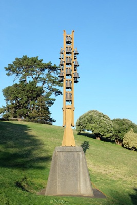
I had to keep my wits about me, because just over the bridge is the Rakaia Salmon statue on the side of the road. 

P1010633

The Rakaia Salmon

After a drive of 70km we arrived at the Ashburton NZMCA Park to stay the next two nights.  Too new to be in the current NZMCA book, Robin found the details in the APP.  Nice and roomy and built in an oval shape with parking on grass.

P1010639P1010640

NZMCA Ashburton

Ashburton was settled in the 1850s and was named after Francis Baring, 3rd Baron Ashburton, who was a member of the Canterbury Association.  The settlers found the plains inhospitable, without trees and constantly buffeted by the continual north westerly winds.  The determined pioneers began working the plains and began producing wheat and other crops, and grazing sheep.  These days local farmers grow potatoes, corn and peas. A vegetable processing factory owned by Talley's is located on the northern outskirts of the town, and was built in 1996 to take advantage of the good soils and irrigation of the Ashburton district.

On Thursday morning we decided to go on an adventure, and explore the Rakai Gorge.  We made a picnic lunch, filled the thermos, and made sure we took along the sun screen and insect repellant too.  The beginning of the drive took us through paddocks of what we presumed to be blueberry bushes, and the eastern side of the Southern Alps loomed up beside us.

P1010643

On our way to Rakaia Gorge

Originally we had thought we hadn't been this way, but when the scenery started to look familiar we remembered we had done this trip on our 2012 SI travels with our friends.  Stopping at the lookout gave us wonderful views of the river, the Rakaia River is another of Canterbury’s braided rivers.

P1010648P1010649

View from the lookout

There is a carved Pou at the lookout which tells the story of the Taniwha of Raikaia.  According to Maori legend a taniwha river monster lives in the Rakaia Gorge.  His efforts to block the north west wind led to the narrowing of the river, when he brought down huge stones and boulders to halt the progress of the north west demon and imprison him.

P1010646

Rakaia Gorge Taniwha Pou

With a name like Windwhistle, we just had to check this tiny settlement out so drove through Rakaia to do so.  All we could find was a small school and a garage.  It is located on State Highway 77 near the Rakaia Gorge.  Windwhistle's name comes from the way the wind sounds when the Canterbury north west wind blows.

P1010650

The only business in this tiny place.

Then we returned to the Rakaia River for lunch, driving down onto the river bank to enjoy the wonderful views and people watch.  Some were frollicking in the river on their boards, others were walking along, still more were putting their boats in the river and departing with a hiss and a roar.  The bank across the river had rows of  different colours laid down,  always interesting to consider how these occurred.  And we watched as trucks, cars and caravans made their way across the two quite different bridges across the river, then slowly drove up the hill.

P1010657

P1010658

Interesting layers in the bank, and two bridging spanning the river

A car arrived from Environmental Canterbury and we watched as a young man went about taking many water samples and readings.  Not a bad place to work, is it, especially in the summer.

P1010655P1010656

Taking water samples

On the way back we stopped off at Methven for a look around and an ice-cream.  This is an interesting place as it is on the edge of the Mount Hutt Ski Field, so in the winter this is a very busy place indeed.

P1010664

This is a town of two pubs, the Blue Pub on one corner and the Brown Pub across the road on the other corner.  The Blue Pub seems to cater for the younger yuppy crowd.

P1010666P1010672

The Blue Pub

The Brown Pub was built in 1923 to replace the former Canterbury Hotel which was destroyed by fire.    This pub seems to appeal to the blokes, it seems to me.

P1010670P1010668

The Brown Pub

We enjoyed our “real fruit ice-creams” in the shady park. along with plenty of others with the same idea.  The ice-cream was so large I couldn't finish mine!

P1010667

Ice cream time

It was a real “Blue Dome” day, fine and sunny, and we enjoyed a great day out.  That’s what caravan holidays are all about, exploring our beautiful country.