Success is getting what you want; happiness is liking what you get
Showing posts with label Monument. Show all posts

Saturday, 4 February 2023

Manapouri

It was goodbye after four nights at Te Anau,  just a skip and jump, 24km drive to our next stop at Manapouri. 

P1020026

Goodbye, Te Anau

We are staying at the Manapouri NZMCA Park, recently purchased by NZMCA.  We can remember staying at this newly opened commercial motor camp back in 2012 when we were on a South Island holiday with several other vans.  Licensed to 50 sites, there is a choice of power or non power, plus toilets, showers, laundry, e-bike charging stations, dump station and rubbish available.  Normal NZMCA rates apply for non power sites,  with extra for power, showers and laundry and e-bike charging.

P1020038

It was reasonably quiet when we arrived, but with the long Waitangi weekend coming up, the caretaker told us he was expecting the camp to fill up very quickly.  And it did, one after another the vans kept rolling in.

P1020039P1020028

Manapouri NZMCA Park

Manapouri derives its name from a Maori word meaning “lake of the sorrowing heart,” with reference to a legend that its waters are the tears of dying sisters.  It is situated in the World Heritage Site Fiordland National Park, with fiords and lakes all carved out by ancient glaciers.

P1020034

P1020035

Lake Manapouri

Those of us with long memories will remember in the 1970s when a plan was proposed to raise the level of Lake Manapouri by 12m to provide more water storage for the Lake Manapouri Power Station.  The prospect of irreparable damage to this most beautiful lake outraged New Zealanders, leading to a nationwide protest and a huge petition presented to Parliament.  Eventfully the idea was scrapped, and meanwhile John Hanlon’s song “Damn the Dam” became the rallying call to stop the travesty.

  Damn the dam cried the fantail,
  As he flew into as he flew into the sky,
  To give power to the people
  All this beauty has to die…

Down at the lakeside is a monument showing just how high the water would have been raised if the plan had gone ahead.  You can see the lake in the distance.

P1020037

“Manapouri Saved”

We have stayed here before so I was aware of the name “Pearl Habour” just out of town where the boat trips leave from.  By why this name, I wondered?  We called into the Info Centre/booking office to find out.  Seems that the name was given to the harbour soon after the Japanese attack on Pearl Harbor, Hawaii in 1941 when during a particularly  low tide many of the boats were found laying on their sides in the mud as if they had been attacked.

P1020032P1020031

Pearl Habour, New Zealand

Fellow campers had recommended The Church café/bistro in town, so we took ourselves there for Saturday lunch, and what a lovely place it was.   Originally Otautau St Andrews Anglican Church St Andrews, this lovely old building was re-sited at Manapouri and found a new purpose in life.  We were joined at our table by another caravanning couple, who, like us, didn't want to eat a meal perched up on bar stools.  Sad to say, but at our age, a dining table and chairs suit us much better.  I’m pleased we arrived early, as family groups soon arrived to fill the place.  Our meals were very tasty indeed, I’m so pleased we came.

P1020050P1020049

Lunch at The Church

P1020052

I love the misty mountains in this area

Wednesday, 15 August 2018

Visiting Fremantle

If there’s one thing Perth can be very proud of, it’s the public transport.  Free buses drive round the CBD, doing four different routes – what a great service.  We took the free Red Cat bus to Perth Station, and boarded the train to Fremantle, which cost us $4.80 each for a 35 minute ride, quite a bargain, we felt.

P1210397
Perth Station

The modern train whisked us through quite a number of stations until we reached our destination. Right in the centre of town we came across some well known Aussie  icons, kookaburras sitting in a tree.

P8151043
Kookaburra

What better thing to do than board the Fremantle Tram Tour to show us the sights, and save our legs.

P1210442
Hop-on Hop-off Tram Tour

Our laid back tour took us through town with lots of interesting older style buildings, and down to the harbour, past both old and new housing,  parks, schools and the hospital.  Many of the former wool warehouses have now been turned into apartments.

P1210403
Hotel in the middle of town

Fremantle was founded in 1829 and established as a “free settlement” with the arrival of 400 settlers.  But as the years went on there was not enough labour to get the town up and running.   The decision was made regardless of the public opinion against, and in  November 1849 it was officially announced that The Swan River Colony as it was known back then  had been ‘constituted a penal settlement’ to accelerate the economic growth.  The first 75 convicts arrived in 1850 to be followed by over nine thousand more convicts before 1868.

P1210424

Fremantle Prison was built as a convict barracks in the 19th century and remained in continual use until 1991. The Prison was a place of hangings, floggings, dramatic convict escapes and prisoner riots. Inmates included imperial convicts, colonial prisoners, enemy aliens, prisoners of war and maximum-security detainees.  Fremantle Prison is one of the largest surviving convict prisons in the world today and is now a World Heritage Site.

Our tour took us up to Monument Hill Memorial Reserve to view the handsome War Memorial.

P1210429

The United States Submariners Memorial was erected in 1967 to honour the bravery and sacrifice made by US Submariners stationed in Fremantle during WW11.

P8151048
Memorials on Monument Hill

Fremantle has a busy harbour with many fishing and pleasure vessels docked.  But the harbour and the Royal Perth Yacht Club will forever be remembered for defending the America’s Cup against Dennis Connor in 1987.  Sadly the Aussies couldn’t hold on to the cup, but Fremantle was put on the world stage during the racing.

P1210479
Down at the harbour

After a light lunch in “Cappuccino Strip”, chock full of cafes and bars, we caught another free Cat bus back to Fremantle Station for our return trip back to Perth.

P1210400
Fremantle Station

Half an hour or so later we were back in Perth, weary feet taking us back to the hotel to take our shoes off,  put our feet up and have a cuppa – oh, the relief. 

P1210488
Our train at Perth Station

Wednesday, 28 February 2018

Not so Sunny Blenheim

Blenheim and nearby Nelson are usually in a bit of a tussle to see which town wins the “sunniest” category each year.  The way it looks to us over the last few days, Blenheim is lagging a bit behind on the sunshine stakes, with grey skies and overnight rain.    Blenheim is named after the Battle of Blenheim (1704), where troops led by John Churchill, 1st Duke of Marlborough defeated a combined French and Bavarian force.

Isn’t this sad?  A trip to the local Info Centre had the road conditions written up on a board – closed, closed, and closed.  Very necessary information for anyone traveling, of course, but to us Kiwis, we must be wondering when all this extreme weather will stop wrecking our roads.  And the time, effort, and cost needed to get them open again.

P1170583
Road closures

We stopped to admire the rather handsome clock tower and war memorial, surrounded by colourful gardens.  The clock tower in Blenheim commemorates all those from the Marlborough Province who died in the First World War. Stones in the upper part consist of Amuri limestone, while those in the lower part are greywacke,  to ensure that all areas were represented by incorporating stones collected from different parts of Marlborough.  Built in 1928, plaques have been added to commemorate men lost in the following wars.

P1170597-001
Clock Tower and War memorial in Blenheim

Mr Whippy came into camp – it may well be a little chilly, but who can resist to the call of Mr Whippy’s musical notes.  Not us, anyway.  And what a friendly fellow he was.

P1170601-001

Staying at the Waterlea Racecourse, as we are, we often hear the sounds of hoof beats on the raceway.  The horses are put through their paces most days, usually bright and early in the morning, although we have seen them out on the track later in the afternoon as well. 

P1170695

One of our neighbours was all set to depart in the early afternoon, but with all the rain, was stuck fast.  But all was not lost, as Robin sprang into action.  Attaching the strop, he then helped pull the motorhome and trailer out of the muddy hole he was stuck in with our trusty Land cruiser.

P1170614P1170617
Robin to the rescue

We took a trip out to the Wairau Bar after reading about this interesting place.  The Wairau Bar is a 19-hectare (47-acre) gravel bar formed where the Wairau River meets the sea in Cloudy Bay, Marlborough.  This area is one of the oldest archaeological sites in New Zealand. Artefacts have been radiocarbon dated to around 1300 AD.

P1170635

P1170647
Wairau Bar

There is also a monument to the European settlers, their wives and families who, from 1832, entered the river bar to found the Province of Marlborough.  A shipping service  for their produce continued until August 1965.   The remains of the old derelict wharf are barely standing, and the sunken hulk of a boat tells of earlier, more prosperous times.

 P1170668
Monument to the settlers who arrived crossing over the bar

P1170659
Cormorant sunning itself on the boat wreck

Another interesting find were the remains of the old flax mill at nearby Marshlands.  The region’s first mill was built in Marshlands, in the lower Wairau, in 1870.  Marlborough had an abundance of flax growing in swampy areas, and the European settlers soon saw its many uses.   Flax fibre was processed and exported for use in ropes, carpets and woolsacks, and by the 1870s Marlborough was an important flax export district.  Although still standing, most of the buildings are in a state of disrepair, and overgrown, and it felt rather like driving through a ghost town.  But this was certainly a thriving business in it’s time.

P1170675

P1170686
The old Flax Mill at Marshlands

That was the end of our exploring in and around Blenheim – and tomorrow we move on to Koromiko, another step closer to boarding the ferry and returning home.

Saturday, 24 February 2018

Cable Bay - Schroders Mistake

Just how many Cable Bay’s are there in New Zealand?  I’m sure we have been to at least a couple of them over the years.  We have now visited another one – about 30km from Richmond.  Our trip took us past the Port of Nelson, and along the waterfront.  A couple of the waterfront cafes are still boarded up following storm damage from an earlier storm last month.  No sign of a storm today, and the water looked rather peaceful and sparkled in the sun shine.

P1170342

We were surprised to see quite a large settlement at Cable Bay, as well as a Motor Camp and Café.  The beach has a boulder bank connecting to Pepin Island that forms part of the Delaware Cable Bay Estuary. Cable Bay was once known as Schroders Mistake, after a Nelson skipper mistook the bay for another and put his boat on the rocks there. The laying of New Zealand's first international telegraph cable gave the bay its modern name. The operation, from Sydney to Cable Bay, took 11 days and transmission began on 21 February 1876. A fire razed the station in 1914 and in 1917 the cable was moved to Titahi Bay, near Wellington.

P1170369

P2241006P2241005
Cable Bay

P1170373
It was a short drive up and over the hill and on to Delaware Inlet.

Delaware Inlet’s sea grass and cockle beds provides habitat and refuge for juvenile fish, and are important feeding grounds for many shore birds.  The banded rail has recently been discovered in this area, and a trapping programme to protect these rare birds is now in place.

P1170381

On our drive back along Pa Road we came across some “rock art” – quite modern it seems.

P1170397
Rock Art on Pa Road

Back in Nelson City again (named after Admiral Horatio Nelson) – and did you know that the first game of rugby was played in New Zealand was at Nelson?  We decided to head up Botanical Hill – somewhere up there was the “Centre of New Zealand”, the sign read.   Maybe not – we didn’t really want an hour’s walk uphill.

P2241014

The geographical "centre of New Zealand" allegedly lies in Nelson on a hilltop near the centre of the city. This is the point "zero, zero" from which the first trigonometrical surveys were started in the 1870s by John Spence Browning, the Chief Surveyor for Nelson.  However,  later surveys have shown that when Stewart Island is included, the actual Centre of New Zealand can be found in the Spooners Range in the Golden Downs Forest.

image
Monument at the top

Although we didn’t make it to the top and actually see the monument, (photo courtesy of the internet) we did get some good views of Nelson Port and City from the hill.

P2241013P2241012

Wednesday, 14 February 2018

Totaranui and back

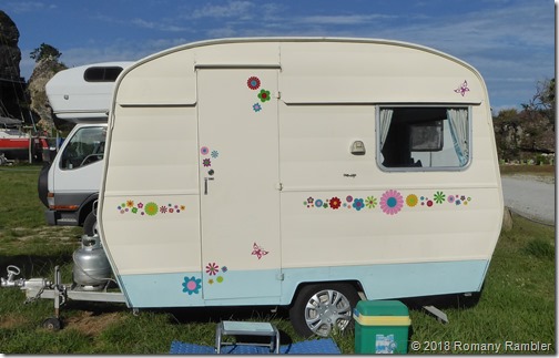
Here at Pohara we are parked beside a dinky little van named Dora, loving painted and decorated with flowers by her owner.  We had 4zees with a group of campers including Dora’s owner yesterday, but sadly her name escapes us.  But we remember that she is from the Wairarapa, lives in a lifestyle village rather like our own, and we have friends in common!

P1160400
Pretty little Dora

Today was a great day to do some more sight-seeing, not quite as hot and sticky as the previous day.  We had decided to visit Totaranui, because we had never been there before.  Our trip started with driving through a hole hacked out of the rock right here in Pohara, and then we were on our way.

P1160403

We reached the end of the sealed road and turned onto a 10km wiggly unsealed road to take us down to Totaranui on the coast. 

P1160425

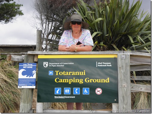
There is a huge DOC campground at Totaranui, which is on the edge of the mighty Abel Tasman National Park.   The place was teeming with walkers, all keen to walk the tracks throughout the park.  Outside the DOC office we saw a group of them all getting instructions.

P1160433P1160436

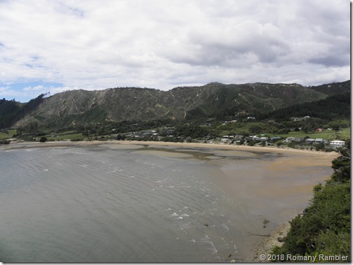
Crowds of campers were milling about down on the beach, ready to board the water taxis and get on their way. Most of them looked young and fit, but there was a sprinkling of older trampers there too.

P1160457

P2140948

P2140947P1160462
Views of the beach

Inside the DOC office, we read about Perrine Moncrieff, the founder of the Abel Tasman National Park.  She wanted to save this pristine area from the loggers, and the MP for Nelson presented the case to Parliament.  1942 was the anniversary of Abel Tasman visit to New Zealand, the park was named in his honour and the Queen of the Netherlands was asked to be patron.  And this marvelous piece of the country was saved for everyone to enjoy.
Back in the car we went, up the hill, and took the other unpaved road down to Awaroa Bay.  This was a bit hair-raising when a huge truck sped towards us on the narrow road.  We backed over to the side of the road as the truck drove past, with inches to spare.

P1160489P1160490

Awaroa Bay has two claims to fame.  The beautiful private beach in the Abel Tasman Park was put up for sale, “Best beach on the planet on the market for two million dollars”, said the headline.  Adam Gardner and Duane Major, a couple of good Kiwi blokes, weren’t going to stand by and let that happen, so they set up a Give-a-little page.  The public got behind them, as did other big players, and the money was raised to purchase the beach.  We couldn’t walk on the very special white sand beach as it was across the estuary, but zoomed in for a photo.

P2140953
Our special beach, now owned by all

The bay is also home to the endangered pateke (brown teal) and young captive bred juvenile birds have been released here in the hope that they will thrive and mate.  These birds are being closely monitored as there are only about 2000 birds left in the wild.

P1160504P1160511

We continued our slow drive back over the hill, and stopped at Tata Beach while we ate our picnic lunch in the sun.  The beach was busy, with swimmers and kayakers, others sunbathing, or walking along the sand.

P1160534
Tata Beach

There was a memorial mosaic bench on the beach, made in the memory of a young woman who had passed away, by four friends.  It really was a work of art and incorporated commercial tiles, together with mosaics made from pottery, glass and beads.

P1160529P1160530
In memory of Kelly

P1160536
Yurts as holiday homes

Lastly, we stopped off at Liger Bay (Named by Abel Tasman as Murderers Bay) to view the Abel Tasman Monument.  We were entertained by the antics of a cheeky weka as we walked up the path.

P2140960P2140957
The flightless weka

P1160605

P2140962
View over Liger Bay

Then it was just a short drive back to Pohara, back through the hole in the rock –maybe it looks different from this side.   It was great to see parts of the country we hadn’t traveled to before.

P1160615
Coming back through

P1160620
Another beautiful sunset